next Trenchard Street Wilton Road previous


Ross-on-Wye

Walford Road

Roman Way (22-12-07)
Roman Way on the site of Tudor Farm (Click for a larger image)

The photo above shows the top entrance to Roman Way as seen from Fernbank Lane.

Prior to the building of the Roman Way estate (locally known as Lego Land), this area was farm land. The farmhouse stood opposite the point where Fernbank Road and Eastfield Road joins Walford Road.

Tudor Farm seen from Walford Road
[Photo: J.C.Coombes]
(Click for a larger image)
Tudor Farm seen from Fernbank Lane
[Photo: J.C.Coombes]
(Click for a larger image)

These photos were taken during the 1970s and, judging by the smoke coming from the chimney, the farmhouse was still occupied at this time.

The large farmhouse was originally a small building that had been extended numerous times.

The Tudor Farm farmhouse
[Photo: J.C.Coombes]
(Click for a larger image)

A Tudor Farm barn
A Tudor Farm barn
[Photo: J.C.Coombes]
(Click for a larger image)

Some of the barns at this time were derelict.


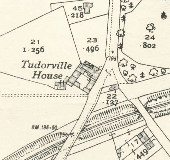
The site of Tudorville House
Tudorville House in 1937
Reproduced from the 1937 Ordnance Survey map. © Crown copyright

Roman Way Estate (22-12-07)
Roman Way Estate (Click for a larger image)


next Trenchard Street Wilton Road previous


[Page updated: Feb 15 2011 13:31:59]


Search the site

© Ross-on-Wye.com & TheVista.co.uk
2002-2012 All Rights Reserved
Guestbook :: Contact details :: RSS News Feed News Feed

Share this article
Facebook Digg Reddit Magnolia Yahoo Google Stumbleupon Technorati Delicious Newsvine
[ Page views: 22711 :: Total page views: 7230731 :: Total visits: 6637126 ]
[ Since: 22:55 29 July 2005 ]
[ Page gen. time: 0.1120 ][ Page enc: ][ SERVER - Load: 62% ]